


| THE MAGNIFICENT |
| MONTEZUMA CASTLE |
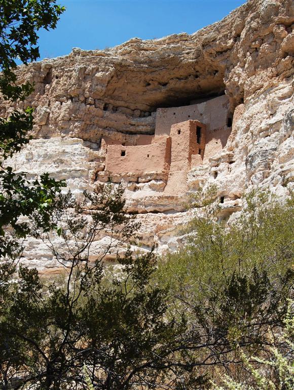
| Montezuma Castle National Monument, located near Camp Verde, Arizona, in the Southwestern United States, features well-preserved cliff dwellings. They were built and used by the Pre-Columbian Sinagua people around 700 AD. Several Hopi clans trace their roots to immigrants from the Montezuma Castle/Beaver Creek area. Clan members periodically return to their former homes for religious ceremonies. When European Americans discovered them in the 1860s, they named them for the Aztec emperor of Mexico Montezuma II, due to mistaken beliefs that the emperor had been connected to their construction. |
| Montezuma Castle National Monument Gaze through the windows of the past into one of the best preserved cliff dwellings in North America. This 20 room high-rise apartment, nestled into a towering limestone cliff, tells a 1,000 year-old story of ingenuity and survival in an unforgiving desert landscape. Marveling at this enduring legacy of the Sinagua culture reveals a people surprisingly similar to ourselves. |
| The National Monument: The castle is located just two miles from I-17 (exit 289) at the end of a side road that winds across flat scrubland and down into the wooded valley formed by Beaver Creek - a small stream, but a reliable source of water all year round and hence a good locality for the Sinagua to establish a home. The national monument has a visitor center with a small museum and bookstore, from where a short paved nature trail leads past the ruins, which are not visible from the approach road, then loops back alongside the creek. About 50 feet west of the main ruin is a much less well preserved complex named Castle B, consisting of a few rudimentary rooms also on several levels. The land surrounding the path is semi-cultivated, planted with good examples of cacti and other local plants. There is a picnic site near the visitor center, in the shade of large sycamore trees overlooking the creek. Since 1951, visitors have not been permitted to climb up to the ruins due to their unstable condition so there is not much to do other than walk the loop trail and take a few photographs but the site is definitely worth a visit. |